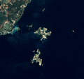
File:Archipel des Lavezzi.png
Appearance

Size of this preview: 634 × 599 pixels. Other resolutions: 254 × 240 pixels | 508 × 480 pixels | 655 × 619 pixels.
Original file (655 × 619 pixels, file size: 463 KB, MIME type: image/png)
File history
Click on a date/time to view the file as it appeared at that time.
| Date/Time | Thumbnail | Dimensions | User | Comment | |
|---|---|---|---|---|---|
| current | 19:15, 24 September 2011 |  | 655 × 619 (463 KB) | Telperion | {{Information |Description ={{en|1=The Lavezzi archipelago, located southeast of mainland Corsica (France). This satellite view was acquired by Landsat 7. The two main islands are |
File usage
The following page uses this file:
Global file usage
The following other wikis use this file:
- Usage on fr.wikipedia.org
- Usage on it.wikivoyage.org
- Usage on lij.wikipedia.org
- Usage on www.wikidata.org


